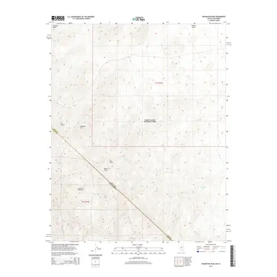
2014 Map of Wahguyhe Peak
USGS Topo · Published 2014About this map
Wahguyhe Peak stands as a prominent landmark in this high-elevation corner of the Amargosa Range, straddling the border of Death Valley National Park. The landscape is defined by its dramatic topographic relief, where the steep descents of Titus Canyon and Fall Canyon cut through the Grapevine Mountains toward the Mojave Desert floor. These deep drainages indicate the erosional forces at work in this arid environment, creating corridors that have historically served as difficult passage routes through the range. Essential water sources are scarce but recorded at scattered locations such as Brier Spring, Alkali Spring, and McDonald Spring. The map clearly delineates the administrative boundary between Nye and Inyo Counties, as well as the state line separating Nevada and California, providing a precise look at how these geopolitical borders bisect the high desert peaks and canyons.
Find a feature on this map
15 named features on this map. Tap any name to fly to it.
Don’t see what you’re looking for? This feature index may not catch every label — zoom into the map to look around manually.
Map Details
Editions of this 2014 Wahguyhe Peak Map
This is the sole edition of this map. No revisions or reprints were ever made.
Other maps of this area

1908 · Kawich
USGS Topo · 1:250,000

1908 · Lida
USGS Topo · 1:250,000

1908 · Furnace Creek
USGS Topo · 1:250,000

1908 · Ballarat
USGS Topo · 1:250,000

1910 · Furnace Creek
USGS Topo · 1:250,000

1913 · Lida
USGS Topo · 1:250,000

1913 · Ballarat
USGS Topo · 1:250,000

1942 · Tolicha Peak
USGS Topo · 1:125,000

1942 · Bullfrog
USGS Topo · 1:125,000

1948 · Death Valley
USGS Topo · 1:250,000