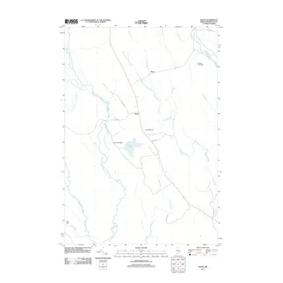
2011 Map of Waite
USGS Topo · Published 2011About this map
Waite serves as the central hub for this corner of Washington County, where Maine Route 1 intersects with local roads like Talmadge Rd and W Lake Rd. The landscape is defined by its intricate drainage patterns, dominated by the East Branch Big Musquash Stream and the winding course of Huntley Brook. Settlements are sparse and largely confined to the roadside, including the small community of Bingo to the north and the localized Democrat Ridge to the west.
Find a feature on this map
28 named features on this map. Tap any name to fly to it.
Don’t see what you’re looking for? This feature index may not catch every label — zoom into the map to look around manually.
Map Details
Editions of this 2011 Waite Map
This is the sole edition of this map. No revisions or reprints were ever made.
Other maps of this area

1940 · Waite
USGS Topo · 1:62,500

1941 · Scraggly Lake
USGS Topo · 1:62,500

1941 · Big Lake
USGS Topo · 1:62,500

1941 · Wabassus Lake
USGS Topo · 1:62,500

1942 · Waite
USGS Topo · 1:62,500

1943 · Big Lake
USGS Topo · 1:62,500

1943 · Wabassus Lake
USGS Topo · 1:62,500

1944 · Scraggly Lake
USGS Topo · 1:62,500

1952 · Big Lake
USGS Topo · 1:50,000

1953 · Wabassus Lake
USGS Topo · 1:62,500