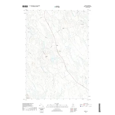
2018 Map of Waite
USGS Topo · Published 2018About this map
Waite and the nearby settlement of Bingo serve as the primary human centers in this heavily forested landscape of eastern Maine. The terrain is defined by a series of north-south running ridges and low mountains, including Democrat Ridge, Neal Mtn, and McLain Mtn. Historically, the area's geography is shaped by its complex water network, most notably the East Branch Big Musquash Stream and West Branch Big Musquash Stream, which meander through extensive wetlands. Roads like Old Mill Rd and Houlton Rd (US Route 1) trace the high ground between these drainages. Patten Pond sits at the heart of the quadrangle, surrounded by several smaller tributaries such as Flipper Creek and Huntley Brook, which underscore the region's long-standing connection to timber and water-based transportation.
Find a feature on this map
31 named features on this map. Tap any name to fly to it.
Don’t see what you’re looking for? This feature index may not catch every label — zoom into the map to look around manually.
Map Details
Editions of this 2018 Waite Map
This is the sole edition of this map. No revisions or reprints were ever made.
Other maps of this area

1940 · Waite
USGS Topo · 1:62,500

1941 · Scraggly Lake
USGS Topo · 1:62,500

1941 · Big Lake
USGS Topo · 1:62,500

1941 · Wabassus Lake
USGS Topo · 1:62,500

1942 · Waite
USGS Topo · 1:62,500

1943 · Big Lake
USGS Topo · 1:62,500

1943 · Wabassus Lake
USGS Topo · 1:62,500

1944 · Scraggly Lake
USGS Topo · 1:62,500

1952 · Big Lake
USGS Topo · 1:50,000

1953 · Wabassus Lake
USGS Topo · 1:62,500