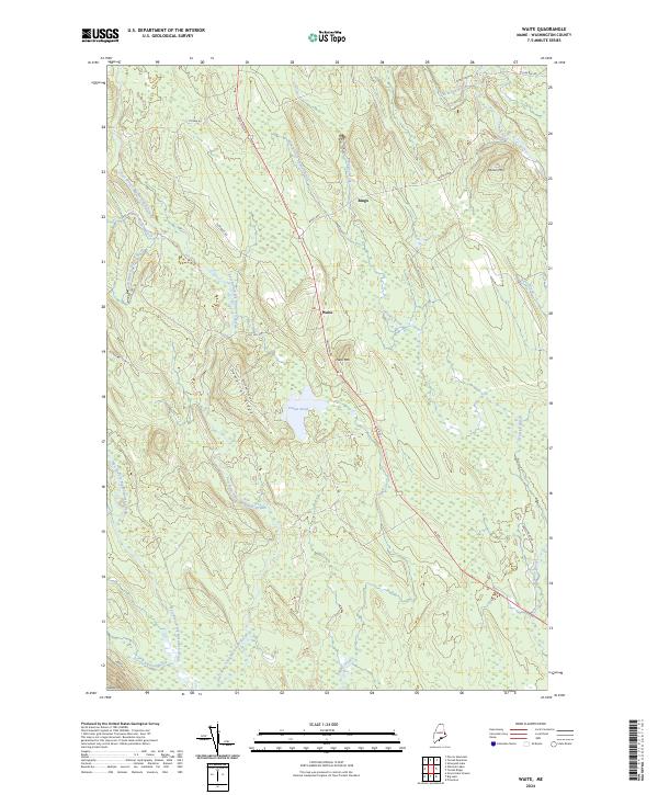
2024 Map of Waite
USGS Topo · Published 2024About this map
Waite and the small settlement of Bingo anchor this remote interior Washington County landscape, where the local road network follows the ridges and drainage patterns of the Maine woods. US Rte 1, known locally as Houlton Rd, serves as the primary north-south artery through the township, passing beneath the slopes of Neal Mtn. The terrain is defined by a dense network of waterways including the East Branch Big Musquash Stream and Huntley Brook, which wind through extensive wetlands and around prominent heights like Democrat Ridge. To the south, Patten Pond provides a significant water feature amidst the timbered hills. For genealogists and local historians, the presence of Old Mill Rd and various family-named landmarks like McLain Mtn provides clues to the area's long history of small-scale settlement and wood products industry in the eastern borderlands.
Find a feature on this map
30 named features on this map. Tap any name to fly to it.
Don’t see what you’re looking for? This feature index may not catch every label — zoom into the map to look around manually.
Map Details
Editions of this 2024 Waite Map
This is the sole edition of this map. No revisions or reprints were ever made.
Other maps of this area

1940 · Waite
USGS Topo · 1:62,500

1941 · Scraggly Lake
USGS Topo · 1:62,500

1941 · Big Lake
USGS Topo · 1:62,500

1941 · Wabassus Lake
USGS Topo · 1:62,500

1942 · Waite
USGS Topo · 1:62,500

1943 · Big Lake
USGS Topo · 1:62,500

1943 · Wabassus Lake
USGS Topo · 1:62,500

1944 · Scraggly Lake
USGS Topo · 1:62,500

1952 · Big Lake
USGS Topo · 1:50,000

1953 · Wabassus Lake
USGS Topo · 1:62,500