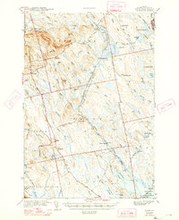
1942 Map of Waite
USGS Topo · Published 1947About this map
Tomah Mountain anchors the northern reaches of this Washington County landscape, a terrain defined by the complex water systems of Tomah Stream and Musquash Stream. Surveyed just before the United States entered World War II, the map illustrates a sparsely populated region where life and labor followed the seasonal rhythms of the forest and the flowage. The settlements of Waite and Codyville are central hubs in a vast network of timber camps and family-owned properties, including Todd Farm, Keeley Farm, and several specialized encampments like Keefe Camp and Longfellow Camp.
Find a feature on this map
81 named features on this map. Tap any name to fly to it.
Don’t see what you’re looking for? This feature index may not catch every label — zoom into the map to look around manually.
Map Details
Editions of this 1942 Waite Map
2 editions found

Other maps of this area

1929 · Calais
USGS Topo · 1:48,000

1930 · Vanceboro
USGS Topo · 1:48,000

1932 · Calais
USGS Topo · 1:62,500

1933 · Vanceboro
USGS Topo · 1:62,500

1940 · Danforth
USGS Topo · 1:62,500

1940 · Waite
USGS Topo · 1:62,500

1940 · Forest
USGS Topo · 1:62,500

1940 · Kellyland
USGS Topo · 1:62,500

1941 · Danforth
USGS Topo · 1:62,500

1941 · Scraggly Lake
USGS Topo · 1:62,500