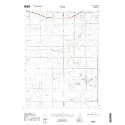
2019 Map of Wakarusa
USGS Topo · Published 2019About this map
The town of Wakarusa anchors this section of northern Indiana, where the landscape is defined by an intricate network of drainage systems essential to the region's agricultural history. Flowing through the center of the sheet, Baugo Creek is joined by numerous named waterways including Werntz Ditch, Barkey Ditch, and the uniquely named Beman Birk Newcomer Ditch. This 2019 survey illustrates the established township divisions of t36n r4e and t37n r4e, showing a transition from the structured residential grid of the town center to the sprawling rural acreage of Eby Field. For genealogists, the map preserves the locations of several burial grounds, such as Pletcher Cem situated within the town limits and the rural Resthaven Cem and Shutts Cem located to the west and north. These landmarks, along with a dense grid of county roads like Madison Rd and Nappanee St, reveal the persistent settlement patterns of this St. Joseph and Elkhart County borderland.
Find a feature on this map
71 named features on this map. Tap any name to fly to it.
Don’t see what you’re looking for? This feature index may not catch every label — zoom into the map to look around manually.
Map Details
Editions of this 2019 Wakarusa Map
This is the sole edition of this map. No revisions or reprints were ever made.
Other maps of this area

1953 · Fort Wayne
USGS Topo · 1:250,000

1953 · Chicago
USGS Topo · 1:250,000

1956 · Fort Wayne
USGS Topo · 1:250,000

1957 · Chicago
USGS Topo · 1:250,000

1958 · South Bend East
USGS Topo · 1:24,000

1958 · Bremen
USGS Topo · 1:24,000

1958 · Nappanee West
USGS Topo · 1:24,000

1958 · Osceola
USGS Topo · 1:24,000

1958 · Nappanee East
USGS Topo · 1:24,000

1960 · Foraker
USGS Topo · 1:24,000