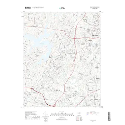
2019 Map of Wake Forest
USGS Topo · Published 2019About this map
The Neuse River winds through the heart of this North Carolina quadrangle, serving as a geographic anchor for a landscape transitioning from the capital city's northern reaches to established collegiate and rural communities. In the northeast, the town of Wake Forest centers around the campus and the Southeastern Baptist Theological Seminary Cem, while the historic settlement of Forestville lies just to the south. The expansion of Raleigh is evident in the dense residential networks developing around the Neuse Crossroads.
Find a feature on this map
331 named features on this map. Tap any name to fly to it.
Don’t see what you’re looking for? This feature index may not catch every label — zoom into the map to look around manually.
Map Details
Editions of this 2019 Wake Forest Map
This is the sole edition of this map. No revisions or reprints were ever made.
Other maps of this area

1943 · Raleigh
USGS Topo · 1:62,500

1943 · Creedmoor
USGS Topo · 1:62,500

1944 · Creedmoor
USGS Topo · 1:62,500

1951 · Raleigh
USGS Topo · 1:62,500

1953 · Raleigh
USGS Topo · 1:250,000

1953 · Greensboro
USGS Topo · 1:250,000

1954 · Greensboro
USGS Topo · 1:250,000

1954 · Raleigh
USGS Topo · 1:250,000

1962 · Greensboro
USGS Topo · 1:250,000

1966 · Greensboro
USGS Topo · 1:250,000