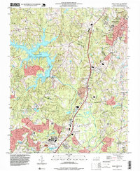
1993 Map of Wake Forest
USGS Topo · Published 1999About this map
The Wake Forest corporate boundary and the northern reaches of Raleigh anchor this detailed landscape as it appeared in the early 1990s. The geography is defined by the massive footprint of Falls Lake and the Falls Lake State Recreation Area, which dramatically altered the local drainage patterns of Richland Creek and Horse Creek. Near the center of the sheet, the Neuse River flows through Neuse Crossroads, a point where historical transport routes converged south of the primary settlement areas.
Find a feature on this map
38 named features on this map. Tap any name to fly to it.
Don’t see what you’re looking for? This feature index may not catch every label — zoom into the map to look around manually.
Map Details
Editions of this 1993 Wake Forest Map
This is the sole edition of this map. No revisions or reprints were ever made.
Other maps of this area

1943 · Raleigh
USGS Topo · 1:62,500

1943 · Creedmoor
USGS Topo · 1:62,500

1944 · Creedmoor
USGS Topo · 1:62,500

1951 · Raleigh
USGS Topo · 1:62,500

1953 · Raleigh
USGS Topo · 1:250,000

1953 · Greensboro
USGS Topo · 1:250,000

1954 · Greensboro
USGS Topo · 1:250,000

1954 · Raleigh
USGS Topo · 1:250,000

1962 · Greensboro
USGS Topo · 1:250,000

1966 · Greensboro
USGS Topo · 1:250,000