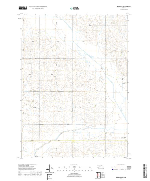
2021 Map of Wakefield SW
USGS Topo · Published 2021About this map
The Logan Creek Dredge defines the hydraulic character of this Nebraska landscape, cutting a straight course through the terrain and leaving behind the meandering Old Channel Logan Creek. This modification of the natural drainage system reflects the region's agricultural history, where channelization was employed to manage water flow across the section lines of t28n r4e and t27n r4e. The settlement of Wakefield sits at the edge of the survey area, positioned near the confluence of South Logan Creek and other small tributaries.
Find a feature on this map
25 named features on this map. Tap any name to fly to it.
Don’t see what you’re looking for? This feature index may not catch every label — zoom into the map to look around manually.
Map Details
Editions of this 2021 Wakefield SW Map
This is the sole edition of this map. No revisions or reprints were ever made.
Other maps of this area

1955 · Sioux City
USGS Topo · 1:250,000

1958 · Sioux City
USGS Topo · 1:250,000

1959 · Sioux City
USGS Topo · 1:250,000

1963 · Wayne
USGS Topo · 1:24,000

1966 · Altona NW
USGS Topo · 1:24,000

1966 · Altona NE
USGS Topo · 1:24,000
1967 · Allen
USGS Topo · 1:24,000

1967 · Wakefield SW
USGS Topo · 1:24,000
1967 · Wakefield
USGS Topo · 1:24,000
1967 · Concord
USGS Topo · 1:24,000