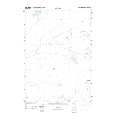
2013 Map of Wakely Mountain
USGS Topo · Published 2013About this map
Kamp Kill Kare sits on the northern shore of Lake Kora in this pocket of the Adirondack Park Preserve. The landscape is dominated by high peaks and ridges, including Wakely Mtn, Bradley Mtn, and Cellar Mtn, which define the drainage basins for numerous brooks and streams. A network of waterways including Sumner Stream, Wakely Brook, and the S Br Moose River wind through the mountainous terrain. The map illustrates a largely wild area where transportation is limited to a few specific corridors like Moose River Rd and Killcare Way. Remote water bodies such as Little Moose Lake, Sly Pond, and Lost Pond highlight the interior wilderness of Hamilton County during the early 21st century.
Find a feature on this map
32 named features on this map. Tap any name to fly to it.
Don’t see what you’re looking for? This feature index may not catch every label — zoom into the map to look around manually.
Map Details
Editions of this 2013 Wakely Mountain Map
This is the sole edition of this map. No revisions or reprints were ever made.
Other maps of this area

1899 · Indian Lake
USGS Topo · 1:62,500

1900 · Canada Lake
USGS Topo · 1:62,500

1902 · Indian Lake
USGS Topo · 1:62,500

1903 · West Canada Lakes
USGS Topo · 1:62,500

1903 · Raquette Lake
USGS Topo · 1:62,500

1903 · Blue Mountain
USGS Topo · 1:62,500

1950 · Utica
USGS Topo · 1:250,000

1954 · Blue Mountain
USGS Topo · 1:62,500

1954 · Indian Lake
USGS Topo · 1:62,500

1954 · West Canada Lakes
USGS Topo · 1:62,500