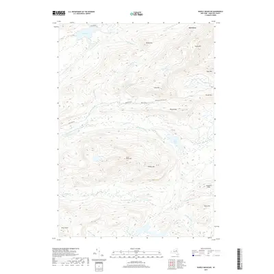
2019 Map of Wakely Mountain
USGS Topo · Published 2019About this map
The Northville Lake Placid Trl winds through this high Adirondack landscape, following the elevation contours between Wilson Ridge and Cellar Mtn. This section of Hamilton County is defined by its complex drainage systems, where the South Branch Moose River and the Cedar River originate from numerous high-altitude basins and wetlands. The map shows a transition from the structured access of Killkare Rd near Lake Kora in the northwest to the more isolated peaks of Wakely Mtn and Manbury Mtn. The dense network of water bodies, including Little Moose Lake, Sly Pond, and Home Pond, illustrates the typical glacial topography of the region. Researchers can trace the path of Moose River Rd as it parallels Butter Brook, providing a clear view of the historical corridor used to traverse this interior wilderness.
Find a feature on this map
35 named features on this map. Tap any name to fly to it.
Don’t see what you’re looking for? This feature index may not catch every label — zoom into the map to look around manually.
Map Details
Editions of this 2019 Wakely Mountain Map
This is the sole edition of this map. No revisions or reprints were ever made.
Other maps of this area

1899 · Indian Lake
USGS Topo · 1:62,500

1900 · Canada Lake
USGS Topo · 1:62,500

1902 · Indian Lake
USGS Topo · 1:62,500

1903 · West Canada Lakes
USGS Topo · 1:62,500

1903 · Raquette Lake
USGS Topo · 1:62,500

1903 · Blue Mountain
USGS Topo · 1:62,500

1950 · Utica
USGS Topo · 1:250,000

1954 · Blue Mountain
USGS Topo · 1:62,500

1954 · Indian Lake
USGS Topo · 1:62,500

1954 · West Canada Lakes
USGS Topo · 1:62,500