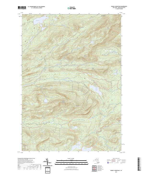
2023 Map of Wakely Mountain
USGS Topo · Published 2023About this map
Wakely Mountain and the high ridges of Hamilton County dominate this modern topographical survey, which traces the complex drainage systems of the Central Adirondacks. The headwaters and tributaries of the South Branch Moose River and the Cedar River carve through a landscape of significant peaks, including Payne Mountain, Cellar Mountain, and Bradley Mountain. This area is characterized by its network of backcountry access points, with the long-distance Northville Lake Placid Trl traversing the northern section near Silver Run.
Find a feature on this map
39 named features on this map. Tap any name to fly to it.
Don’t see what you’re looking for? This feature index may not catch every label — zoom into the map to look around manually.
Map Details
Editions of this 2023 Wakely Mountain Map
This is the sole edition of this map. No revisions or reprints were ever made.
Other maps of this area

1899 · Indian Lake
USGS Topo · 1:62,500

1900 · Canada Lake
USGS Topo · 1:62,500

1902 · Indian Lake
USGS Topo · 1:62,500

1903 · West Canada Lakes
USGS Topo · 1:62,500

1903 · Raquette Lake
USGS Topo · 1:62,500

1903 · Blue Mountain
USGS Topo · 1:62,500

1950 · Utica
USGS Topo · 1:250,000

1954 · Blue Mountain
USGS Topo · 1:62,500

1954 · Indian Lake
USGS Topo · 1:62,500

1954 · West Canada Lakes
USGS Topo · 1:62,500