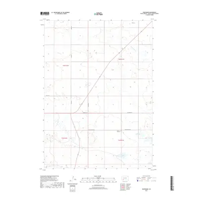
2017 Map of Wakpamani
USGS Topo · Published 2017About this map
Wakpamani and the surrounding high plains of Oglala Lakota County are defined by a network of historical transit routes and ephemeral water sources. The landscape is marked by the transition from older corridors like Old Hwy 18 and Wakpamni Old Rd to the more modern New Wakpamni RD BIA. These routes trace the drainage patterns of Bartlett Cr and Stinking Water Cr, which feed into local basins including Feather on Head Lake and Wakpamani Lake.
Find a feature on this map
17 named features on this map. Tap any name to fly to it.
Don’t see what you’re looking for? This feature index may not catch every label — zoom into the map to look around manually.
Map Details
Editions of this 2017 Wakpamani Map
This is the sole edition of this map. No revisions or reprints were ever made.
Other maps of this area

1955 · Hot Springs
USGS Topo · 1:250,000

1955 · Alliance
USGS Topo · 1:250,000

1957 · Alliance
USGS Topo · 1:250,000

1958 · Alliance
USGS Topo · 1:250,000

1967 · Wounded Knee
USGS Topo · 1:24,000

1967 · Denby
USGS Topo · 1:24,000

1969 · Clinton NE
USGS Topo · 1:24,000
1969 · Hog Island
USGS Topo · 1:24,000
1969 · Gordon NW
USGS Topo · 1:24,000
1981 · Wakpamani
USGS Topo · 1:25,000