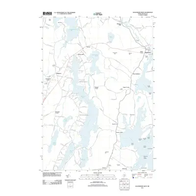
2011 Map of Waldoboro West
USGS Topo · Published 2011About this map
The Medomak River and its estuary system define this coastal landscape, where the tidal waters meet the interior lake country of Lincoln County. The Waldoboro Dam serves as a transition point near the town center of Waldoboro, where the river narrows before opening into the Hockomock Channel. Moving inland, the geography is a dense network of freshwater bodies including Pemaquid Pond, Biscay Pond, and Duckpuddle Pond, interspersed with family-named settlements like Eugley Corner, Sprague Corner, and Knowlton Corner.
Find a feature on this map
70 named features on this map. Tap any name to fly to it.
Don’t see what you’re looking for? This feature index may not catch every label — zoom into the map to look around manually.
Map Details
Editions of this 2011 Waldoboro West Map
This is the sole edition of this map. No revisions or reprints were ever made.
Other maps of this area

1893 · Wiscasset
USGS Topo · 1:62,500

1893 · Boothbay
USGS Topo · 1:62,500

1904 · Monhegan
USGS Topo · 1:62,500

1906 · Monhegan
USGS Topo · 1:62,500

1913 · Waldoboro
USGS Topo · 1:48,000

1915 · Waldoboro
USGS Topo · 1:62,500

1941 · Waldoboro
USGS Topo · 1:62,500

1941 · Boothbay
USGS Topo · 1:62,500

1943 · Boothbay
USGS Topo · 1:62,500

1944 · Wiscasset
USGS Topo · 1:62,500