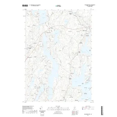
2021 Map of Waldoboro West
USGS Topo · Published 2021About this map
Damariscotta Lake and the Medomak River anchor this mid-coast Maine landscape, where numerous family cemeteries offer a deep record of local genealogy. Several branches of the Chapman family are represented by the Chapman Nathaniel Chapman Sally Cem, Chapman Jacob Chapman Jane Cem, and Chapman Alden Cem, while the German Protestant Cem near Waldoboro reflects the unique cultural heritage of the area's early settlers. The Central Maine & Quebec Railway corridor cuts through the northern section, passing through Winslows Mills and Glendon. The peninsula between Broad Cove and the Medomak River is marked by long-standing settlements like West Waldoboro and Medomak, leading down to coastal features such as Dutch Neck and Keene Neck on the edge of Muscongus Bay.
Find a feature on this map
152 named features on this map. Tap any name to fly to it.
Don’t see what you’re looking for? This feature index may not catch every label — zoom into the map to look around manually.
Map Details
Editions of this 2021 Waldoboro West Map
This is the sole edition of this map. No revisions or reprints were ever made.
Other maps of this area

1893 · Wiscasset
USGS Topo · 1:62,500

1893 · Boothbay
USGS Topo · 1:62,500

1904 · Monhegan
USGS Topo · 1:62,500

1906 · Monhegan
USGS Topo · 1:62,500

1913 · Waldoboro
USGS Topo · 1:48,000

1915 · Waldoboro
USGS Topo · 1:62,500

1941 · Waldoboro
USGS Topo · 1:62,500

1941 · Boothbay
USGS Topo · 1:62,500

1943 · Boothbay
USGS Topo · 1:62,500

1944 · Wiscasset
USGS Topo · 1:62,500