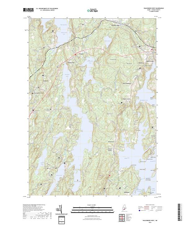
2024 Map of Waldoboro West
USGS Topo · Published 2024About this map
The Medomak River valley and its surrounding coastal peninsulas anchor this detailed survey of mid-coast Maine. The landscape is defined by its deep saltwater inlets like Broad Cove and Muscongus Bay, alongside significant freshwater bodies including Pemaquid Pond and the southern reaches of Damariscotta Lake. The map reveals a high concentration of family-named burial grounds, such as the Chapman Nathaniel Chapman Sally Cem and Chapman Jacob Chapman Jane Cem, which provide specific genealogical markers across the countryside. Settlements like Winslows Mills and Waldoboro serve as historical centers of activity, while the network of roads including Keene Neck Rd and Winslows Mills Rd connect the disparate necks and islands that characterize this tidal region. This layout reflects a centuries-old maritime and agricultural heritage where transport was dictated by the complex intersection of river, bay, and rocky hills.
Find a feature on this map
76 named features on this map. Tap any name to fly to it.
Don’t see what you’re looking for? This feature index may not catch every label — zoom into the map to look around manually.
Map Details
Editions of this 2024 Waldoboro West Map
This is the sole edition of this map. No revisions or reprints were ever made.
Other maps of this area

1893 · Wiscasset
USGS Topo · 1:62,500

1893 · Boothbay
USGS Topo · 1:62,500

1904 · Monhegan
USGS Topo · 1:62,500

1906 · Monhegan
USGS Topo · 1:62,500

1913 · Waldoboro
USGS Topo · 1:48,000

1915 · Waldoboro
USGS Topo · 1:62,500

1941 · Waldoboro
USGS Topo · 1:62,500

1941 · Boothbay
USGS Topo · 1:62,500

1943 · Boothbay
USGS Topo · 1:62,500

1944 · Wiscasset
USGS Topo · 1:62,500