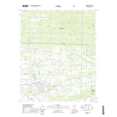
2020 Map of Waldron
USGS Topo · Published 2020About this map
The Scott County Courthouse stands as the central landmark of Waldron, situated at the intersection of local industry and the expansive Ouachita National Forest. This 2020 survey reveals a landscape where the Poteau River and its numerous tributaries, such as Clear Cr and Square Rock Cr, define the drainage patterns of the valley floor. Notable elevations like Pilot Knob and Square Rock Ridge rise to the north, while Waldron Ridge and Bohnstein Hill border the settlement to the south. For those researching local heritage, the map identifies several significant burial grounds, including Old Salem Cem, Square Rock Cem, and Duncan Cem. The infrastructure of the era is well-represented, from the Waldron Municipal Airport to the recreational waters of Lake Waldron and the Poteau River Site Five Lake.
Find a feature on this map
107 named features on this map. Tap any name to fly to it.
Don’t see what you’re looking for? This feature index may not catch every label — zoom into the map to look around manually.
Map Details
Editions of this 2020 Waldron Map
This is the sole edition of this map. No revisions or reprints were ever made.
Other maps of this area

1879 · Poteau Mountain
USGS Topo · 1:62,500

1887 · Poteau Mountain #1
USGS Topo · 1:62,500

1887 · Mount Ida #2
USGS Topo · 1:62,500

1887 · Magazine Mountain #3
USGS Topo · 1:62,500

1887 · Magazine Mountain
USGS Topo · 1:62,500

1890 · Magazine Mountain
USGS Topo · 1:125,000

1890 · Mount Ida
USGS Topo · 1:125,000

1890 · Fort Smith
USGS Topo · 1:125,000

1890 · Poteau Mountain
USGS Topo · 1:125,000

1899 · Poteau Mountain
USGS Topo · 1:125,000