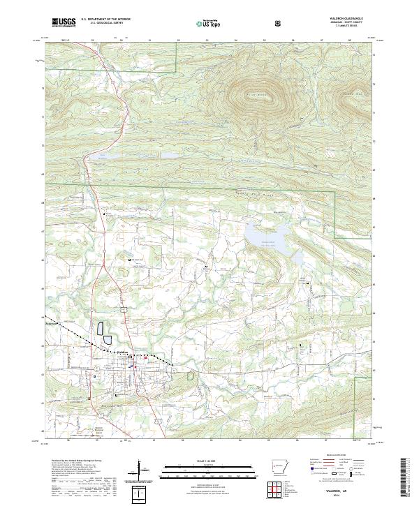
2024 Map of Waldron
USGS Topo · Published 2024About this map
Waldron serves as the focal point for this region of Scott County, positioned at the confluence of several key waterways including the Poteau River and Clear Creek. The town's administrative significance is marked by the central Scott County Courthouse, while its broader geography is defined by the high ground of Square Rock Ridge and Bohnstein Hill. To the north, the terrain rises sharply toward Pilot Knob and Round Mtn within the protected expanse of the Ouachita National Forest.
Find a feature on this map
117 named features on this map. Tap any name to fly to it.
Don’t see what you’re looking for? This feature index may not catch every label — zoom into the map to look around manually.
Map Details
Editions of this 2024 Waldron Map
This is the sole edition of this map. No revisions or reprints were ever made.
Other maps of this area

1879 · Poteau Mountain
USGS Topo · 1:62,500

1887 · Poteau Mountain #1
USGS Topo · 1:62,500

1887 · Mount Ida #2
USGS Topo · 1:62,500

1887 · Magazine Mountain #3
USGS Topo · 1:62,500

1887 · Magazine Mountain
USGS Topo · 1:62,500

1890 · Magazine Mountain
USGS Topo · 1:125,000

1890 · Mount Ida
USGS Topo · 1:125,000

1890 · Fort Smith
USGS Topo · 1:125,000

1890 · Poteau Mountain
USGS Topo · 1:125,000

1899 · Poteau Mountain
USGS Topo · 1:125,000