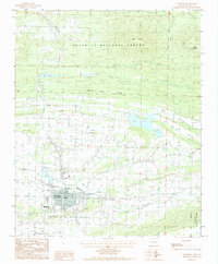
1983 Map of Waldron
USGS Topo · Published 1984About this map
Waldron sits at the confluence of several vital water systems in the early 1980s, where the Poteau River meets Muddy Creek and East Fork of the Poteau. The town's layout reflects a classic Ozark foothills development, anchored by the Kansas City Southern railroad and the modern utility of the Waldron City Airport. To the north, the landscape rises into the Ouachita National Forest, dominated by topographic high points such as Pilot Knob and Round Mountain. The presence of Lake Waldron and the lengthy Square Rock Ridge provides a clear view of how the local terrain dictated settlement patterns, pushing residential and commercial growth into the flatter river valleys while leaving the timbered ridges to the national forest. Small localities like Anderson and the named route of Bohnstein suggest the localized geography important to family researchers in Scott County.
Find a feature on this map
20 named features on this map. Tap any name to fly to it.
Don’t see what you’re looking for? This feature index may not catch every label — zoom into the map to look around manually.
Map Details
Editions of this 1983 Waldron Map
This is the sole edition of this map. No revisions or reprints were ever made.
Other maps of this area

1879 · Poteau Mountain
USGS Topo · 1:62,500

1887 · Poteau Mountain #1
USGS Topo · 1:62,500

1887 · Mount Ida #2
USGS Topo · 1:62,500

1887 · Magazine Mountain #3
USGS Topo · 1:62,500

1887 · Magazine Mountain
USGS Topo · 1:62,500

1890 · Magazine Mountain
USGS Topo · 1:125,000

1890 · Mount Ida
USGS Topo · 1:125,000

1890 · Fort Smith
USGS Topo · 1:125,000

1890 · Poteau Mountain
USGS Topo · 1:125,000

1899 · Poteau Mountain
USGS Topo · 1:125,000