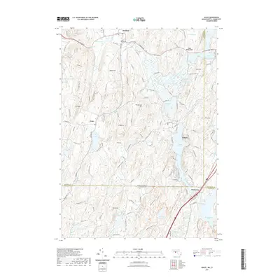
2021 Map of Wales
USGS Topo · Published 2021About this map
Brimfield and Wales anchor this survey of the South-Central Massachusetts and Northern Connecticut borderlands, where the landscape is defined by the winding course of the Quinebaug River. This area is characterized by significant water bodies that served both industry and recreation, including the large Hamilton Reservoir and the expansive East Brimfield Lake. The terrain is punctuated by notable heights like Mt Pisgah and Rattlesnake Mtn, which overlook a network of valley settlements and historic cemeteries such as Brimfield Cem and Holland Cem. The map illustrates the transition from the Massachusetts towns in Hampden County and Worcester County into the Connecticut village of Mashapaug within Tolland County. Small tributaries like Lombards Brook and Mill Brook traverse the wooded hills, reflecting the region's traditional New England upland character.
Find a feature on this map
131 named features on this map. Tap any name to fly to it.
Don’t see what you’re looking for? This feature index may not catch every label — zoom into the map to look around manually.
Map Details
Editions of this 2021 Wales Map
This is the sole edition of this map. No revisions or reprints were ever made.
Other maps of this area

1887 · Brookfield
USGS Topo · 1:62,500

1887 · Palmer
USGS Topo · 1:62,500

1889 · Palmer
USGS Topo · 1:62,500

1890 · Brookfield
USGS Topo · 1:62,500

1892 · Woodstock
USGS Topo · 1:62,500

1892 · Tolland
USGS Topo · 1:62,500

1893 · Palmer
USGS Topo · 1:62,500

1893 · Brookfield
USGS Topo · 1:62,500

1908 · Ware
USGS Topo · 1:125,000

1915 · Brookfield
USGS Topo · 1:62,500