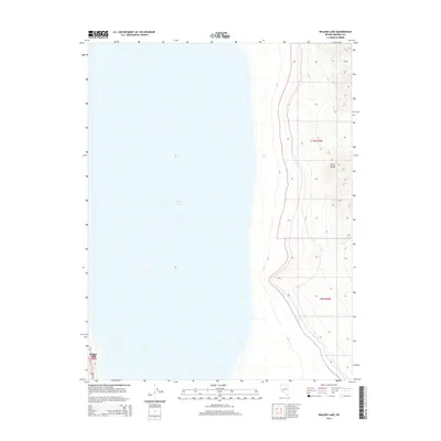
2014 Map of Walker Lake
USGS Topo · Published 2014About this map
Walker Lake dominates the western half of this Nevada landscape, appearing here as it was surveyed in the early 21st century. The map illustrates the stark transition from the deep blue expanse of the lake to the rising elevations of the Gillis Range to the east. The terrain is marked by the distinctive topography of the Great Basin, where steep contours define the ridges and canyons of the range. The administrative geography is recorded through the Public Land Survey System boundaries of Walker Lake R29E, t10n r30e, and t9n r30e, providing a precise framework for researchers and land historians studying this portion of Mineral County.
Find a feature on this map
5 named features on this map. Tap any name to fly to it.
Don’t see what you’re looking for? This feature index may not catch every label — zoom into the map to look around manually.
Map Details
Editions of this 2014 Walker Lake Map
This is the sole edition of this map. No revisions or reprints were ever made.
Other maps of this area

1909 · Hawthorne
USGS Topo · 1:250,000

1911 · Hawthorne
USGS Topo · 1:250,000

1915 · Hawthorne
USGS Topo · 1:250,000

1948 · Walker Lake
USGS Topo · 1:250,000

1955 · Hawthorne
USGS Topo · 1:62,500

1956 · Mt. Grant
USGS Topo · 1:62,500

1957 · Walker Lake
USGS Topo · 1:250,000

1962 · Walker Lake
USGS Topo · 1:250,000

1964 · Walker Lake
USGS Topo · 1:250,000

1964 · Gillis Canyon
USGS Topo · 1:62,500