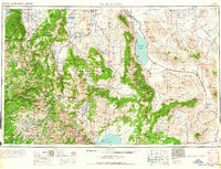
1964 Map of Walker Lake
USGS Topo · Published 1964About this map
Yosemite National Park and the high peaks of the Sierra Nevada dominate the southwestern portion of this 1964 survey, transitioning into the arid basin and range landscape of western Nevada. The map highlights a region defined by mineral extraction and military presence, notably the sprawling Naval Ammunition Depot near Hawthorne and large-scale operations like the Anaconda Copper Mine. Significant hydrographic features including Walker Lake, Mono Lake, and Topaz Lake provide a stark contrast to the surrounding alkaline flats of Rhodes Salt Marsh and Columbus Salt Marsh. Cultural history is evidenced by the presence of Bodie and the noted remains of Belleville (ruins) and Candelaria (ruins), marking the locations of earlier mining booms. The Southern Pacific railroad remains a primary transport artery through the Soda Spring Valley, connecting long-established agricultural and mining centers.
Find a feature on this map
136 named features on this map. Tap any name to fly to it.
Don’t see what you’re looking for? This feature index may not catch every label — zoom into the map to look around manually.
Map Details
Editions of this 1964 Walker Lake Map
2 editions found

Other maps of this area

1889 · Pyramid Peak
USGS Topo · 1:125,000

1889 · Markleeville
USGS Topo · 1:125,000

1891 · Carson
USGS Topo · 1:125,000

1891 · Markleeville
USGS Topo · 1:125,000

1891 · Truckee
USGS Topo · 1:125,000

1891 · Big Trees
USGS Topo · 1:125,000

1891 · Wabuska
USGS Topo · 1:125,000

1891 · Pyramid Peak
USGS Topo · 1:125,000

1891 · Wellington
USGS Topo · 1:125,000

1893 · Carson
USGS Topo · 1:125,000