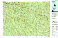
1994 Map of Wallace
USGS Topo · Published 1994About this map
The Bitterroot Range forms a formidable natural boundary between Idaho and Montana, anchoring a landscape defined by industrial extraction and expansive timberlands. This mid-1990s survey illustrates the high density of mining operations concentrated along the Interstate corridor near Wallace and Mullan, including the Galena Mine, Lucky Friday Mine, and Star Mine. These sites speak to the region's enduring identity as the Silver Valley, where geology dictated the placement of every mountain settlement.
Find a feature on this map
54 named features on this map. Tap any name to fly to it.
Don’t see what you’re looking for? This feature index may not catch every label — zoom into the map to look around manually.
Map Details
Editions of this 1994 Wallace Map
This is the sole edition of this map. No revisions or reprints were ever made.
Other maps of this area

1901 · Coeur D'Alene District
USGS Topo · 1:62,500

1903 · Coeur D'Alene District
USGS Topo · 1:62,500

1906 · Coeur D'Alene District
USGS Topo · 1:62,500

1909 · Cataldo
USGS Topo · 1:125,000

1911 · Cataldo
USGS Topo · 1:125,000

1911 · Lolo
USGS Topo · 1:250,000

1913 · Lolo
USGS Topo · 1:250,000

1914 · Avery
USGS Topo · 1:125,000

1917 · Avery
USGS Topo · 1:125,000

1918 · St Regis
USGS Topo · 1:125,000