
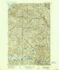
1911 Map of Cataldo
USGS Topo · Published 1911About this map
Mining and timber operations dominate this survey of the Panhandle region, where the North Fork Coeur d'Alene River meets the rugged interior of the Coeur d'Alene National Forest. The landscape is a network of remote ranching outposts like Magee Ranch and early industrial camps, with the O. R. & N. Co. railroad providing a vital link for the silver and lead districts. Industrial activity is concentrated at sites such as the Keep Cool Mine, Weber Mine, and Handspike Mine, which were essential to the local economy during this era of extraction.
Find a feature on this map
122 named features on this map. Tap any name to fly to it.
Don’t see what you’re looking for? This feature index may not catch every label — zoom into the map to look around manually.
Map Details
Editions of this 1911 Cataldo Map
2 editions found
Other maps of this area

1901 · Sandpoint
USGS Topo · 1:125,000

1901 · Coeur D'Alene District
USGS Topo · 1:62,500

1903 · Rathdrum
USGS Topo · 1:125,000

1903 · Coeur D'Alene District
USGS Topo · 1:62,500

1906 · Coeur D'Alene District
USGS Topo · 1:62,500

1909 · Cataldo
USGS Topo · 1:125,000

1911 · Priest Lake
USGS Topo · 1:250,000

1911 · Sandpoint
USGS Topo · 1:125,000

1913 · Priest Lake
USGS Topo · 1:250,000

1914 · Avery
USGS Topo · 1:125,000