
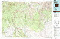
1982 Map of Wallowa
USGS Topo · Published 1983About this map
The Grande Ronde River and its major tributaries, including the Wallowa River and Minam River, carve a complex drainage pattern through the Blue Mountains in this early 1980s look at Northeast Oregon. The landscape is defined by its deep canyons and high plateaus, such as Eden Ridge and Bartlett Ridge, which support a mix of national forest and wildlife management lands. Small, isolated settlements like Bartlett, Troy, and Flora are scattered across the higher flats, while the town of Wallowa serves as a primary hub in the lower valley.
Find a feature on this map
93 named features on this map. Tap any name to fly to it.
Don’t see what you’re looking for? This feature index may not catch every label — zoom into the map to look around manually.
Map Details
Editions of this 1982 Wallowa Map
2 editions found
Other maps of this area

1906 · Telocaset
USGS Topo · 1:125,000

1919 · Walla Walla
USGS Topo · 1:125,000

1921 · Walla Walla
USGS Topo · 1:125,000

1937 · Pomeroy
USGS Topo · 1:96,000

1942 · Pomeroy
USGS Topo · 1:125,000

1943 · Saddle Butte
USGS Topo · 1:62,500

1944 · Anatone
USGS Topo · 1:62,500

1946 · Saddle Butte
USGS Topo · 1:62,500

1946 · Limekiln Rapids
USGS Topo · 1:62,500

1946 · Anatone
USGS Topo · 1:62,500