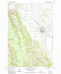
1964 Map of Wallowa
USGS Topo · Published 1985About this map
The Wallowa River valley serves as the central artery for this 1964 topographic study, revised in the early 1980s to reflect the evolving landscape of northeastern Oregon. The town of Wallowa sits at the junction of the river and the Union Pacific railroad, characterized by its grid layout, local Athletic Field, and nearby Wallowa Cem. The surrounding terrain transitions sharply from the level agricultural lands of Diamond Prairie and Goebel Flat to the steep, timbered draws of the Wallowa National Forest.
Find a feature on this map
36 named features on this map. Tap any name to fly to it.
Don’t see what you’re looking for? This feature index may not catch every label — zoom into the map to look around manually.
Map Details
Editions of this 1964 Wallowa Map
2 editions found
Other maps of this area

1906 · Telocaset
USGS Topo · 1:125,000

1955 · Grangeville
USGS Topo · 1:250,000

1957 · Enterprise
USGS Topo · 1:62,500

1957 · Sled Springs
USGS Topo · 1:62,500

1959 · Grangeville
USGS Topo · 1:250,000

1964 · Howard Butte
USGS Topo · 1:24,000

1964 · Akers Butte
USGS Topo · 1:24,000

1964 · Wallowa
USGS Topo · 1:24,000

1964 · Minam
USGS Topo · 1:24,000

1965 · Fox Point
USGS Topo · 1:24,000