
1964 Map of Akers Butte
USGS Topo · Published 1965About this map
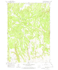
Maxville stands as a focal point in the northern reach of this 1964 survey, situated within the expansive Wallowa National Forest. The landscape is defined by its verticality, rising from the deep incisions of Tamarack Canyon and Reagin Gulch to the heights of Akers Butte and Middle Point. This era in Wallowa County reveals a terrain primarily managed for timber and range, crisscrossed by a network of trails and unimproved jeep roads that connect remote water sources like Johnson Spring and Tub Spring.
Find a feature on this map
26 named features on this map. Tap any name to fly to it.
Don’t see what you’re looking for? This feature index may not catch every label — zoom into the map to look around manually.
Map Details
Editions of this 1964 Akers Butte Map
2 editions found
Other maps of this area

1955 · Grangeville
USGS Topo · 1:250,000

1957 · Sled Springs
USGS Topo · 1:62,500

1959 · Grangeville
USGS Topo · 1:250,000

1964 · Howard Butte
USGS Topo · 1:24,000

1964 · Wallowa
USGS Topo · 1:24,000

1964 · Minam
USGS Topo · 1:24,000

1967 · Wood Butte
USGS Topo · 1:24,000

1967 · Promise
USGS Topo · 1:24,000
1967 · Deep Creek
USGS Topo · 1:24,000

1982 · Wallowa
USGS Topo · 1:100,000