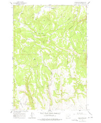
1964 Map of Akers Butte
USGS Topo · Published 1978About this map
Akers Butte and the surrounding terrain of Wallowa County define this mid-century survey, which documents the remote landscapes of the Wallowa National Forest. The settlement of Maxville appears in the northern reaches near Bishop Creek, while further south, the Landing Strip and Weinhard mark pockets of human activity amidst the high ridges. This era of mapping shows a network of unnamed trails and specifically identified Jeep Trails that provided access to fire lookouts and grazing lands before more modern road developments took hold.
Find a feature on this map
25 named features on this map. Tap any name to fly to it.
Don’t see what you’re looking for? This feature index may not catch every label — zoom into the map to look around manually.
Map Details
Editions of this 1964 Akers Butte Map
2 editions found
Other maps of this area

1955 · Grangeville
USGS Topo · 1:250,000

1957 · Sled Springs
USGS Topo · 1:62,500

1959 · Grangeville
USGS Topo · 1:250,000

1964 · Howard Butte
USGS Topo · 1:24,000

1964 · Akers Butte
USGS Topo · 1:24,000

1964 · Wallowa
USGS Topo · 1:24,000

1964 · Minam
USGS Topo · 1:24,000

1967 · Wood Butte
USGS Topo · 1:24,000

1967 · Promise
USGS Topo · 1:24,000
1967 · Deep Creek
USGS Topo · 1:24,000