
1967 Map of Wood Butte
USGS Topo · Published 1971About this map
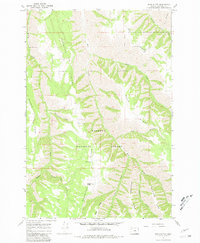
Powwatka Ridge and a series of dramatic geographic fingers define this section of the Wallowa National Forest during the late 1960s. The landscape is characterized by steep drainage systems where Wildcat Creek, Mud Creek, and Buck Creek carve through the high country. Small-scale human activity is visible at the Olson settlement and along the Courtney Trail, indicating the area's use for forestry and recreation. The mapping of Wood Butte and nearby Middle Point provides precise elevation data for the ridges that separate these vital watersheds, such as Kuhn Ridge and Washboard Ridge. This survey is particularly useful for understanding the trail and road networks that provided access to the deep canyons and high ridges of Wallowa County before more modern developments.
Find a feature on this map
21 named features on this map. Tap any name to fly to it.
Don’t see what you’re looking for? This feature index may not catch every label — zoom into the map to look around manually.
Map Details
Editions of this 1967 Wood Butte Map
2 editions found
Other maps of this area

1955 · Grangeville
USGS Topo · 1:250,000

1957 · Sled Springs
USGS Topo · 1:62,500

1959 · Grangeville
USGS Topo · 1:250,000

1964 · Akers Butte
USGS Topo · 1:24,000

1967 · Troy
USGS Topo · 1:24,000

1967 · Eden
USGS Topo · 1:24,000
1967 · Shamrock Creek
USGS Topo · 1:24,000

1967 · Promise
USGS Topo · 1:24,000
1967 · Flora
USGS Topo · 1:24,000

1982 · Wallowa
USGS Topo · 1:100,000