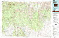
1982 Map of Wallowa
USGS Topo · Published 1983About this map
The Grande Ronde River and its deep-cut canyons dominate the landscape of Northeast Oregon in the early 1980s, where traditional timber and ranching activities meet the protected reaches of the Wenaha-Tucannon Wilderness. Small ranching settlements and former logging sites are scattered throughout the region, including Maxville, Powwatka, and Flora. The Union Pacific railroad tracks follow the winding course of the Wallowa River through Minam and into the valley toward Wallowa. Higher elevations are defined by long, narrow landforms such as Powwatka Ridge and Eden Ridge, punctuated by fire observation points like the Courtney Butte Lookout. This map captures a transition period in land management, showing the interface between the Umatilla National Forest and the rugged canyonlands near the Hells Canyon National Recreation Area boundary.
Find a feature on this map
68 named features on this map. Tap any name to fly to it.
Don’t see what you’re looking for? This feature index may not catch every label — zoom into the map to look around manually.
Map Details
Editions of this 1982 Wallowa Map
2 editions found

Other maps of this area

1906 · Telocaset
USGS Topo · 1:125,000

1919 · Walla Walla
USGS Topo · 1:125,000

1921 · Walla Walla
USGS Topo · 1:125,000

1937 · Pomeroy
USGS Topo · 1:96,000

1942 · Pomeroy
USGS Topo · 1:125,000

1943 · Saddle Butte
USGS Topo · 1:62,500

1944 · Anatone
USGS Topo · 1:62,500

1946 · Saddle Butte
USGS Topo · 1:62,500

1946 · Limekiln Rapids
USGS Topo · 1:62,500

1946 · Anatone
USGS Topo · 1:62,500