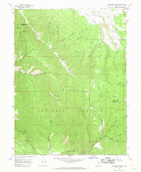
1967 Map of Wallsburg Ridge
USGS Topo · Published 1969About this map
Uinta National Forest lands dominate this mid-century topographic record, defined by the prominent spine of Wallsburg Ridge and the heights of Rattlesnake Mountain. The terrain is deeply incised by complex drainage systems, including the South Fork Provo River and its various forks to the west, and the waters of Hobble Creek to the south. Distinctive landmarks such as Bald Knoll and the level expanses of Balsam Bench and Wing Flat provide clear points of orientation within this mountainous landscape.
Find a feature on this map
41 named features on this map. Tap any name to fly to it.
Don’t see what you’re looking for? This feature index may not catch every label — zoom into the map to look around manually.
Map Details
Editions of this 1967 Wallsburg Ridge Map
This is the sole edition of this map. No revisions or reprints were ever made.
Other maps of this area

1885 · Salt Lake
USGS Topo · 1:250,000

1907 · Strawberry Valley
USGS Topo · 1:125,000

1909 · Strawberry Valley
USGS Topo · 1:125,000

1948 · Orem
USGS Topo · 1:62,500

1948 · Springville
USGS Topo · 1:24,000

1948 · Aspen Grove
USGS Topo · 1:24,000

1948 · Bridal Veil Falls
USGS Topo · 1:24,000

1949 · Provo
USGS Topo · 1:62,500

1950 · Aspen Grove
USGS Topo · 1:24,000
1950 · Bridal Veil Falls
USGS Topo · 1:24,000