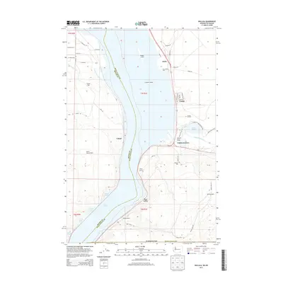
2014 Map of Wallula
USGS Topo · Published 2014About this map
Lake Wallula dominates this reach of the Columbia River, marking the confluence with the Walla Walla River as it passes through the gap between the Horse Heaven Hills and the higher ground to the east. The river geography is defined by a network of islands and inlets, including Badger Island, Crescent Island, and Smiths Harbor, providing a deep-water landscape for the Port of Walla Walla. The settlement pattern follows the rail and river corridors, with Wallula and Attalia positioned along the eastern shore while the lonely station of Yellepit sits on the western bank in Benton County. The Madame Dorion Bridge provides a vital link across the water near Wallula Junction, connecting the varied terrain of the Clover Hill heights with the riparian flats. Evidence of local industry and infrastructure is seen in the Broetge Orchards and the remnants of irrigation efforts like Columbia Canal Number 3.
Find a feature on this map
54 named features on this map. Tap any name to fly to it.
Don’t see what you’re looking for? This feature index may not catch every label — zoom into the map to look around manually.
Map Details
Editions of this 2014 Wallula Map
This is the sole edition of this map. No revisions or reprints were ever made.
Other maps of this area

1908 · Umatilla
USGS Topo · 1:125,000

1915 · Wallulah
USGS Topo · 1:96,000

1917 · Pasco
USGS Topo · 1:125,000

1918 · Wallula
USGS Topo · 1:125,000

1935 · Pendleton
USGS Topo · 1:125,000

1953 · Pendleton
USGS Topo · 1:250,000

1953 · Walla Walla
USGS Topo · 1:250,000

1956 · Pendleton
USGS Topo · 1:250,000

1958 · Walla Walla
USGS Topo · 1:250,000

1962 · Juniper
USGS Topo · 1:24,000