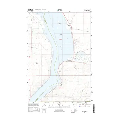
2017 Map of Wallula
USGS Topo · Published 2017About this map
The Columbia River carves a dramatic path through this 2017 study of the Washington-Oregon border, where the river narrows at the iconic Wallula Gap. This geologically significant area serves as a vital transportation corridor, connecting the settlements of Wallula, Attalia, and Wallula Junction along the eastern bank. The confluence of the Walla Walla River and Lake Wallula dominates the central landscape, while the Horse Heaven Hills rise to the west. Industrial and agricultural infrastructure is evident in the presence of Port Kelley and the Columbia Canal Number 3. Cultural landmarks include the Madame Dorion Bridge and the Wallula Horse Trail, which reflect the region's layered history of transit and recreation near the basalt formations of the Twin Sisters.
Find a feature on this map
51 named features on this map. Tap any name to fly to it.
Don’t see what you’re looking for? This feature index may not catch every label — zoom into the map to look around manually.
Map Details
Editions of this 2017 Wallula Map
This is the sole edition of this map. No revisions or reprints were ever made.
Other maps of this area

1908 · Umatilla
USGS Topo · 1:125,000

1915 · Wallulah
USGS Topo · 1:96,000

1917 · Pasco
USGS Topo · 1:125,000

1918 · Wallula
USGS Topo · 1:125,000

1935 · Pendleton
USGS Topo · 1:125,000

1953 · Pendleton
USGS Topo · 1:250,000

1953 · Walla Walla
USGS Topo · 1:250,000

1956 · Pendleton
USGS Topo · 1:250,000

1958 · Walla Walla
USGS Topo · 1:250,000

1962 · Juniper
USGS Topo · 1:24,000