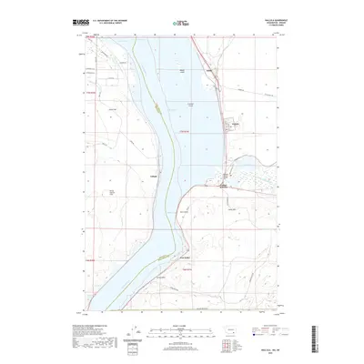
2020 Map of Wallula
USGS Topo · Published 2020About this map
The Columbia River carves through the dramatic basalt gap of the Horse Heaven Hills at the border of Benton and Walla Walla counties. This 2020 survey documents the modern confluence where the Walla Walla River meets Lake Wallula, an area historically significant for its river-and-rail navigation. The settlement of Wallula sits north of the river mouth, while Wallula Junction and the Madame Dorion Bridge serve as critical transit points across the water.
Find a feature on this map
49 named features on this map. Tap any name to fly to it.
Don’t see what you’re looking for? This feature index may not catch every label — zoom into the map to look around manually.
Map Details
Editions of this 2020 Wallula Map
This is the sole edition of this map. No revisions or reprints were ever made.
Other maps of this area

1908 · Umatilla
USGS Topo · 1:125,000

1915 · Wallulah
USGS Topo · 1:96,000

1917 · Pasco
USGS Topo · 1:125,000

1918 · Wallula
USGS Topo · 1:125,000

1935 · Pendleton
USGS Topo · 1:125,000

1953 · Pendleton
USGS Topo · 1:250,000

1953 · Walla Walla
USGS Topo · 1:250,000

1956 · Pendleton
USGS Topo · 1:250,000

1958 · Walla Walla
USGS Topo · 1:250,000

1962 · Juniper
USGS Topo · 1:24,000