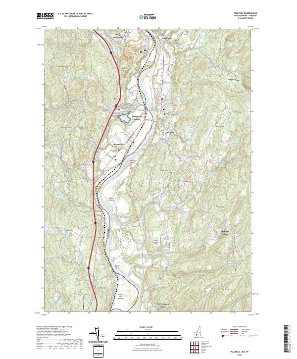
2024 Map of Walpole
USGS Topo · Published 2024About this map
The Connecticut River serves as the primary geographic and political boundary on this map, separating Windham County, Vermont, from Cheshire County, New Hampshire. Along its banks, the settlements of Westminster and Walpole represent long-standing river valley communities, connected by early transportation routes and the modern Cheshire Rec Rail Trl. The landscape is dotted with evidence of early civic life, particularly through its numerous burial grounds like Westminster Old Cem and Walpole Village Cem.
Find a feature on this map
144 named features on this map. Tap any name to fly to it.
Don’t see what you’re looking for? This feature index may not catch every label — zoom into the map to look around manually.
Map Details
Editions of this 2024 Walpole Map
This is the sole edition of this map. No revisions or reprints were ever made.
Other maps of this area

1891 · Brattleboro
USGS Topo · 1:62,500

1893 · Brattleboro
USGS Topo · 1:62,500

1898 · Keene
USGS Topo · 1:62,500

1927 · Bellows Falls
USGS Topo · 1:48,000

1930 · Saxtons River
USGS Topo · 1:48,000

1930 · Bellows Falls
USGS Topo · 1:62,500

1932 · Brattleboro
USGS Topo · 1:48,000

1932 · Keene
USGS Topo · 1:62,500

1933 · Saxtons River
USGS Topo · 1:62,500
1935 · Brattleboro
USGS Topo · 1:62,500