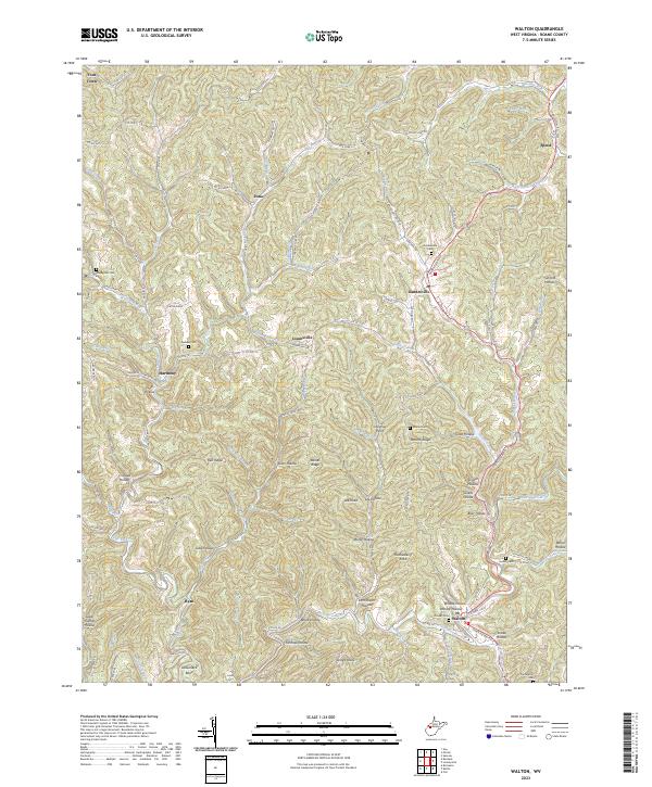
2023 Map of Walton
USGS Topo · Published 2023About this map
The Pocatalico River meanders through this deeply dissected corner of Roane County, serving as the central drainage for a dense network of hollows and ridges. Near the southern edge, Walton sits at the junction of several smaller waterways, including Johnson Creek and Sycamore Branch. The landscape is defined by its many named hollows, such as Snake Hollow and Sam Shafer Hollow, which suggest a long history of family homesteads and local land use.
Find a feature on this map
82 named features on this map. Tap any name to fly to it.
Don’t see what you’re looking for? This feature index may not catch every label — zoom into the map to look around manually.
Map Details
Editions of this 2023 Walton Map
This is the sole edition of this map. No revisions or reprints were ever made.
Other maps of this area
1906 · Kenna
USGS Topo · 1:62,500

1906 · Walton
USGS Topo · 1:62,500
1907 · Kenna
USGS Topo · 1:62,500

1907 · Spencer
USGS Topo · 1:62,500
1907 · Walton
USGS Topo · 1:62,500

1907 · Ripley
USGS Topo · 1:62,500
1926 · Ripley
USGS Topo · 1:62,500
1928 · Spencer
USGS Topo · 1:62,500
1928 · Ripley
USGS Topo · 1:62,500
1954 · Charleston
USGS Topo · 1:250,000