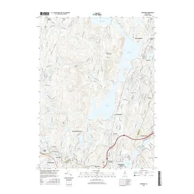
2016 Map of Wanaque
USGS Topo · Published 2016About this map
Wanaque Reservoir and Monksville Reservoir dominate the central geography of this Passaic County landscape, illustrating the critical role of the Highlands in New Jersey's water infrastructure. The survey details the established residential patterns of Wanaque, Bloomingdale, and Pompton Lakes, alongside smaller enclaves like Stonetown and Erskine Lakes. In the north, Greenwood Lake Airport and the smaller Hill-Top Airport mark the era's light aviation footprint.
Find a feature on this map
203 named features on this map. Tap any name to fly to it.
Don’t see what you’re looking for? This feature index may not catch every label — zoom into the map to look around manually.
Map Details
Editions of this 2016 Wanaque Map
This is the sole edition of this map. No revisions or reprints were ever made.
Other maps of this area

1888 · Morristown
USGS Topo · 1:62,500

1888 · Paterson
USGS Topo · 1:62,500

1891 · Greenwood Lake
USGS Topo · 1:62,500

1891 · Ramapo
USGS Topo · 1:62,500

1892 · Paterson
USGS Topo · 1:62,500

1893 · Greenwood Lake
USGS Topo · 1:62,500

1893 · Ramapo
USGS Topo · 1:62,500

1894 · Morristown
USGS Topo · 1:62,500

1898 · Morristown
USGS Topo · 1:62,500

1898 · Paterson
USGS Topo · 1:62,500