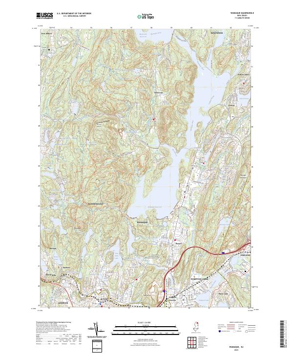
2023 Map of Wanaque
USGS Topo · Published 2023About this map
The Wanaque Reservoir and Monksville Reservoir dominate this Passaic County landscape, shaping the modern layout of the surrounding communities. From the industrial heritage near Pompton Junction to the residential enclaves of Erskine Lakes and Pines Lake, this map documents the dense suburban development interwoven with protected woodlands. Traces of the region's earlier industrial history are preserved in labels like Roomy Mine and the complex transportation network that includes the Greenwood Lake Tpke and Sloatsburg Rd.
Find a feature on this map
122 named features on this map. Tap any name to fly to it.
Don’t see what you’re looking for? This feature index may not catch every label — zoom into the map to look around manually.
Map Details
Editions of this 2023 Wanaque Map
This is the sole edition of this map. No revisions or reprints were ever made.
Other maps of this area

1888 · Morristown
USGS Topo · 1:62,500

1888 · Paterson
USGS Topo · 1:62,500

1891 · Greenwood Lake
USGS Topo · 1:62,500

1891 · Ramapo
USGS Topo · 1:62,500

1892 · Paterson
USGS Topo · 1:62,500

1893 · Greenwood Lake
USGS Topo · 1:62,500

1893 · Ramapo
USGS Topo · 1:62,500

1894 · Morristown
USGS Topo · 1:62,500

1898 · Morristown
USGS Topo · 1:62,500

1898 · Paterson
USGS Topo · 1:62,500