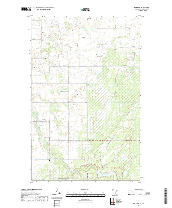
2022 Map of Wannaska NE
USGS Topo · Published 2022About this map
Falun Cem and Saint Phillips Cem anchor the northern reaches of this Roseau County landscape, reflecting the long-established rural communities of northern Minnesota. The terrain is defined by its complex hydrology, where the Roseau River winds through the southern sections, joined by tributaries such as Severson Cr and Rafferty Cr. Human engineering is evident in the managed water systems like County Ditch Number Twentyone, which crisscross the low-lying areas to support local agriculture. In the southeastern portion, a dense network of specialized trails, including the Bemis Hill-Trolls Trl and various forest roads, suggests a landscape heavily used for timber management and seasonal recreation. For genealogists, the inclusion of remote burial sites like Beaver Cem and Pine Grove Cem provides specific points of interest for tracing family history within these surveyed townships.
Find a feature on this map
44 named features on this map. Tap any name to fly to it.
Don’t see what you’re looking for? This feature index may not catch every label — zoom into the map to look around manually.
Map Details
Editions of this 2022 Wannaska NE Map
This is the sole edition of this map. No revisions or reprints were ever made.
Other maps of this area

1918 · Goos
USGS Topo · 1:62,500

1918 · Pencer
USGS Topo · 1:62,500

1918 · Warroad
USGS Topo · 1:62,500

1943 · Goos
USGS Topo · 1:62,500

1943 · Warroad
USGS Topo · 1:62,500

1954 · Roseau
USGS Topo · 1:250,000

1957 · Roseau
USGS Topo · 1:250,000

1958 · Roseau
USGS Topo · 1:250,000

1966 · Malung
USGS Topo · 1:24,000
1966 · Salol
USGS Topo · 1:24,000