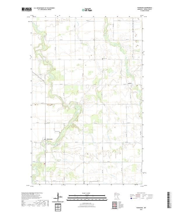
2022 Map of Wannaska
USGS Topo · Published 2022About this map
Wannaska serves as the primary focal point in this portion of Roseau County, where the S Fork Roseau River meanders northward through a landscape defined by an orderly grid of section lines and gravel roads. This contemporary survey details the hydraulic management of the region, specifically through infrastructure like County Ditch Number Twentyone, which integrates with natural tributaries such as Norin Cr and Paulson Cr. The settlement of Pencer and landmarks like Mickinock Cem and Salem Cem provide essential anchor points for local historians and genealogists. The map illustrates a rural environment where agricultural land is partitioned by long avenues and streets, following the township and range divisions of T160N and R39W, maintaining a settlement pattern that has persisted for generations in northern Minnesota.
Find a feature on this map
41 named features on this map. Tap any name to fly to it.
Don’t see what you’re looking for? This feature index may not catch every label — zoom into the map to look around manually.
Map Details
Editions of this 2022 Wannaska Map
This is the sole edition of this map. No revisions or reprints were ever made.
Other maps of this area

1918 · Goos
USGS Topo · 1:62,500

1918 · Pencer
USGS Topo · 1:62,500

1918 · Roseau
USGS Topo · 1:62,500

1918 · Garland
USGS Topo · 1:62,500

1943 · Goos
USGS Topo · 1:62,500

1954 · Roseau
USGS Topo · 1:250,000

1957 · Roseau
USGS Topo · 1:250,000

1958 · Roseau
USGS Topo · 1:250,000

1966 · Malung
USGS Topo · 1:24,000
1966 · Roseau
USGS Topo · 1:24,000