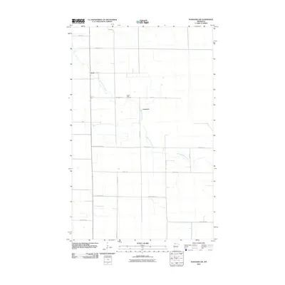
2010 Map of Wannaska SW
USGS Topo · Published 2010About this map
The South Fork Roseau River winds through this rural landscape in Roseau County, defining the drainage patterns and historical settlement of this northern Minnesota region. The small communities of Torfin and Casperson anchor the survey area, connected by a network of sectional roads and county highways that reflect the rigid agricultural grid of the northern plains. This 2010 digital survey preserves the location of Golden Valley Cemetery, a vital landmark for genealogical research and local history. Beyond the natural river course, human modification of the landscape is evident through water management features such as Judicial Ditch Number 63, which serves the low-lying terrain. The map provides a detailed view of the infrastructure supporting this farming district, including County Hwy-144 and County Hwy-18 crossing the river.
Find a feature on this map
19 named features on this map. Tap any name to fly to it.
Don’t see what you’re looking for? This feature index may not catch every label — zoom into the map to look around manually.
Map Details
Editions of this 2010 Wannaska SW Map
This is the sole edition of this map. No revisions or reprints were ever made.
Other maps of this area

1918 · Rollis
USGS Topo · 1:62,500

1918 · Pencer
USGS Topo · 1:62,500

1918 · Garland
USGS Topo · 1:62,500

1919 · Liner
USGS Topo · 1:62,500

1943 · Rollis
USGS Topo · 1:62,500

1954 · Roseau
USGS Topo · 1:250,000

1957 · Roseau
USGS Topo · 1:250,000

1958 · Roseau
USGS Topo · 1:250,000

1962 · Gatzke
USGS Topo · 1:24,000
1967 · Thief Lake NE
USGS Topo · 1:24,000