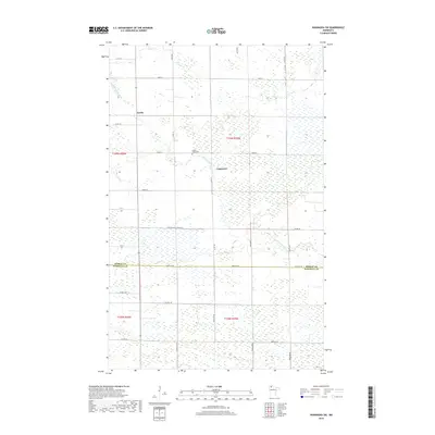
2019 Map of Wannaska SW
USGS Topo · Published 2019About this map
The S Fork Roseau River and its managed water systems define this borderland between Roseau and Marshall counties. Centered on the townships of T159N and T158N, the landscape reflects a tradition of rural engineering, most notably evidenced by the long reach of Judicial Ditch Number 63. This region is sparsely settled, with the tiny nodes of Torfin and Casperson providing the only primary markers of human concentration amidst a sprawling network of numbered county and township roads.
Find a feature on this map
33 named features on this map. Tap any name to fly to it.
Don’t see what you’re looking for? This feature index may not catch every label — zoom into the map to look around manually.
Map Details
Editions of this 2019 Wannaska SW Map
This is the sole edition of this map. No revisions or reprints were ever made.
Other maps of this area

1918 · Rollis
USGS Topo · 1:62,500

1918 · Pencer
USGS Topo · 1:62,500

1918 · Garland
USGS Topo · 1:62,500

1919 · Liner
USGS Topo · 1:62,500

1943 · Rollis
USGS Topo · 1:62,500

1954 · Roseau
USGS Topo · 1:250,000

1957 · Roseau
USGS Topo · 1:250,000

1958 · Roseau
USGS Topo · 1:250,000

1962 · Gatzke
USGS Topo · 1:24,000
1967 · Thief Lake NE
USGS Topo · 1:24,000