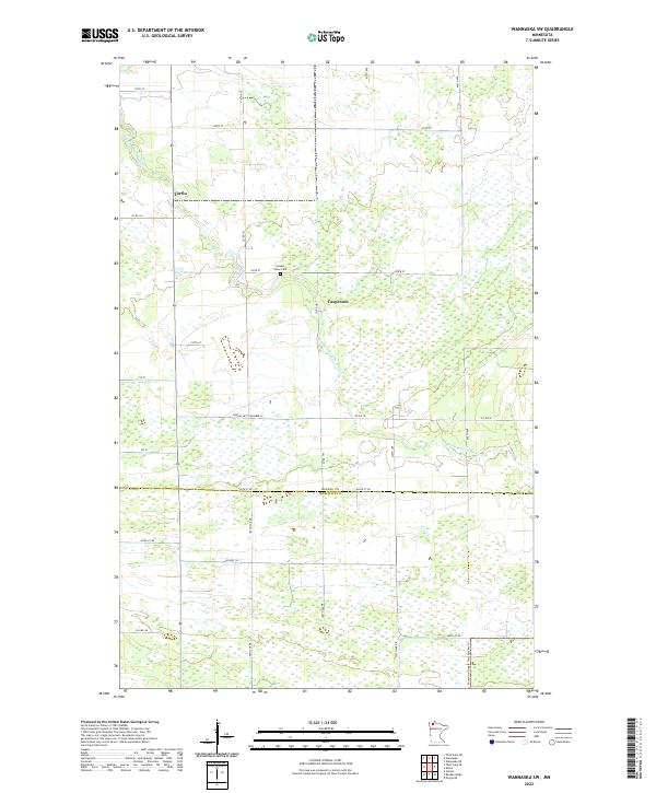
2022 Map of Wannaska SW
USGS Topo · Published 2022About this map
The S Fork Roseau River meanders across this northern Minnesota landscape, where the agricultural grid meets the extensive wetlands of the northern borderlands. The small settlement of Torfin and the locality of Casperson anchor the rural landscape, which is marked by the transition between Roseau and Marshall counties. Significant drainage infrastructure is visible through the Judicial Ditch Number 63, a feature characteristic of the region's historical efforts to manage water for farming and settlement. For genealogists and local historians, the Golden Valley Cem provides a specific point of interest near the river's bend. The southern portion of the map includes the northern reach of the Fourtown-Grygla Trail System Trl, reflecting the area's modern recreational usage alongside its traditional rural character.
Find a feature on this map
33 named features on this map. Tap any name to fly to it.
Don’t see what you’re looking for? This feature index may not catch every label — zoom into the map to look around manually.
Map Details
Editions of this 2022 Wannaska SW Map
This is the sole edition of this map. No revisions or reprints were ever made.
Other maps of this area

1918 · Rollis
USGS Topo · 1:62,500

1918 · Pencer
USGS Topo · 1:62,500

1918 · Garland
USGS Topo · 1:62,500

1919 · Liner
USGS Topo · 1:62,500

1943 · Rollis
USGS Topo · 1:62,500

1954 · Roseau
USGS Topo · 1:250,000

1957 · Roseau
USGS Topo · 1:250,000

1958 · Roseau
USGS Topo · 1:250,000

1962 · Gatzke
USGS Topo · 1:24,000
1967 · Thief Lake NE
USGS Topo · 1:24,000