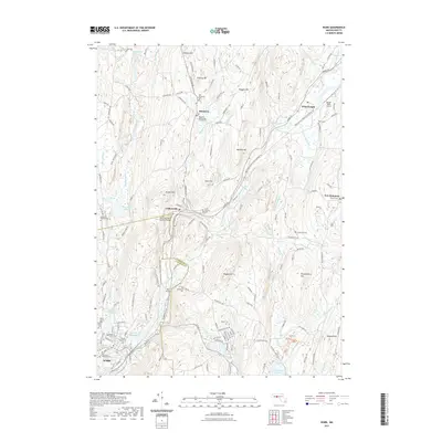
2021 Map of Ware
USGS Topo · Published 2021About this map
The Ware River carves through the heart of this central Massachusetts landscape, connecting the industrial centers of Ware and Gilbertville with the smaller outposts of Hardwick and Wheelwright. This recent survey illustrates a transition from dense settlement in the south to a more dispersed agricultural and conservation-focused character in the north. The presence of the Ware-Hardwick Covered Bridge and several early burying grounds, including the Hardwick Old Burying Ground Cem and Southwest Cem, provides significant detail for local historians. Transportation history is prominent through the Mass Central/Ware to Hardwick Trl, tracing the path of a former rail line that once fueled the local economy. The area is defined by its water resources, from the Ware River Reservoir and Wickaboag Pond to the numerous brooks such as Danforth Brook and Wigimisset Brook that feed the river system.
Find a feature on this map
142 named features on this map. Tap any name to fly to it.
Don’t see what you’re looking for? This feature index may not catch every label — zoom into the map to look around manually.
Map Details
Editions of this 2021 Ware Map
This is the sole edition of this map. No revisions or reprints were ever made.
Other maps of this area

1887 · Brookfield
USGS Topo · 1:62,500

1887 · Palmer
USGS Topo · 1:62,500

1887 · Belchertown
USGS Topo · 1:62,500

1887 · Barre
USGS Topo · 1:62,500

1889 · Palmer
USGS Topo · 1:62,500

1889 · Barre
USGS Topo · 1:62,500

1890 · Belchertown
USGS Topo · 1:62,500

1890 · Brookfield
USGS Topo · 1:62,500

1893 · Palmer
USGS Topo · 1:62,500

1893 · Belchertown
USGS Topo · 1:62,500