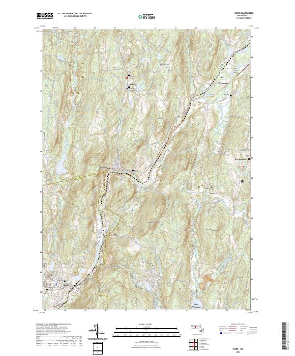
2024 Map of Ware
USGS Topo · Published 2024About this map
The Ware River valley serves as the central artery for this portion of Worcester County, where industrial history and rural highlands meet. The settlement of Ware dominates the southern edge, while the villages of Gilbertville and Wheelwright track the river’s path northward toward Hardwick. This modern survey reveals a landscape deeply layered with local history, particularly through its numerous burial grounds. Genealogists will find many significant sites including the Hardwick Old Burying Ground Cem, Old Saint Williams Cem, and the Methodist Cem.
Find a feature on this map
143 named features on this map. Tap any name to fly to it.
Don’t see what you’re looking for? This feature index may not catch every label — zoom into the map to look around manually.
Map Details
Editions of this 2024 Ware Map
This is the sole edition of this map. No revisions or reprints were ever made.
Other maps of this area

1887 · Brookfield
USGS Topo · 1:62,500

1887 · Palmer
USGS Topo · 1:62,500

1887 · Belchertown
USGS Topo · 1:62,500

1887 · Barre
USGS Topo · 1:62,500

1889 · Palmer
USGS Topo · 1:62,500

1889 · Barre
USGS Topo · 1:62,500

1890 · Belchertown
USGS Topo · 1:62,500

1890 · Brookfield
USGS Topo · 1:62,500

1893 · Palmer
USGS Topo · 1:62,500

1893 · Belchertown
USGS Topo · 1:62,500