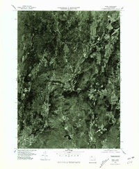
1975 Map of Ware
USGS Topo · Published 1981About this map
Gilbertville and Wheelwright sit along the winding course of the Ware River in this 1975 aerial orthophotograph, which reveals the land-use patterns of central Massachusetts during the mid-1970s. The imagery highlights the tight relationship between the river and the industrial-residential clusters that formed at its bends. While the villages of Hardwick and New Braintree anchor the surrounding highlands, the dense woods and agricultural clearings around Ragged Hill dominate much of the quadrangle's interior. This survey, published in 1981 by the Geological Survey, provides an unvarnished view of the region's topography, from the developed town centers like Ware in the southwest to the rural reaches of the Pioneer Valley's eastern edge.
Find a feature on this map
7 named features on this map. Tap any name to fly to it.
Don’t see what you’re looking for? This feature index may not catch every label — zoom into the map to look around manually.
Map Details
Editions of this 1975 Ware Map
This is the sole edition of this map. No revisions or reprints were ever made.
Other maps of this area

1887 · Brookfield
USGS Topo · 1:62,500

1887 · Palmer
USGS Topo · 1:62,500

1887 · Belchertown
USGS Topo · 1:62,500

1887 · Barre
USGS Topo · 1:62,500

1889 · Palmer
USGS Topo · 1:62,500

1889 · Barre
USGS Topo · 1:62,500

1890 · Belchertown
USGS Topo · 1:62,500

1890 · Brookfield
USGS Topo · 1:62,500

1893 · Palmer
USGS Topo · 1:62,500

1893 · Belchertown
USGS Topo · 1:62,500