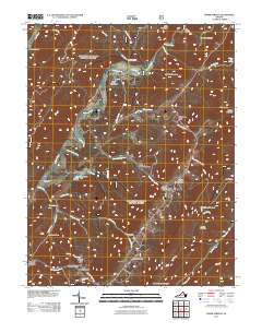
2011 Map of Warm Springs
USGS Topo · Published 2011About this map
Warm Springs and West Warm Springs serve as the central hub of this Bath County landscape, where the waters of Warm Springs Run follow the valley floor. The map highlights a network of small residential clusters and named settlements like Bacova, Mitchelltown, and Thomastown, often situated near water sources such as Jerry Run or along the winding paths of State Rte 687. The Jackson River carves through the western terrain, passing near the Warwick Mansion and the Hidden Valley Campground, illustrating a long-standing relationship between the valley's inhabitants and its river systems.
Find a feature on this map
52 named features on this map. Tap any name to fly to it.
Don’t see what you’re looking for? This feature index may not catch every label — zoom into the map to look around manually.
Map Details
Editions of this 2011 Warm Springs Map
This is the sole edition of this map. No revisions or reprints were ever made.
Other maps of this area

1894 · Natural Bridge
USGS Topo · 1:125,000

1901 · Monterey
USGS Topo · 1:125,000

1923 · Warm Springs
USGS Topo · 1:48,000

1926 · Warm Springs
USGS Topo · 1:62,500

1929 · Falling Spring
USGS Topo · 1:24,000

1930 · Warm Springs Run
USGS Topo · 1:24,000

1930 · Mountain Grove
USGS Topo · 1:24,000

1931 · Healing Springs
USGS Topo · 1:24,000

1932 · Falling Spring
USGS Topo · 1:31,680

1933 · Mountain Grove
USGS Topo · 1:31,680