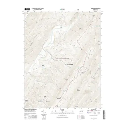
2016 Map of Warm Springs
USGS Topo · Published 2016About this map
Warm Springs and the surrounding thermal waters anchor this landscape in the heart of the George Washington National Forest. The settlement pattern reflects the area's long-standing reliance on its natural geology, with Warm Springs Baths and the Warm Springs Cem serving as significant local landmarks. The Jackson River cuts through the western portion of the map, supporting a corridor of smaller communities including Bacova, Crowdertowne, and Mitchelltown. The terrain is defined by the tight parallel ridges of Warm Springs Mtn and Back Creek Mtn, which frame the namesake Warm Springs Valley. This survey captures the distinct transition from the forested heights of Cobbler Mtn and Little Mountain to the agricultural and recreational pockets near Hidden Valley and Hot Springs.
Find a feature on this map
55 named features on this map. Tap any name to fly to it.
Don’t see what you’re looking for? This feature index may not catch every label — zoom into the map to look around manually.
Map Details
Editions of this 2016 Warm Springs Map
This is the sole edition of this map. No revisions or reprints were ever made.
Other maps of this area

1894 · Natural Bridge
USGS Topo · 1:125,000

1901 · Monterey
USGS Topo · 1:125,000

1923 · Warm Springs
USGS Topo · 1:48,000

1926 · Warm Springs
USGS Topo · 1:62,500

1929 · Falling Spring
USGS Topo · 1:24,000

1930 · Warm Springs Run
USGS Topo · 1:24,000

1930 · Mountain Grove
USGS Topo · 1:24,000

1931 · Healing Springs
USGS Topo · 1:24,000

1932 · Falling Spring
USGS Topo · 1:31,680

1933 · Mountain Grove
USGS Topo · 1:31,680