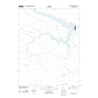
2012 Map of Warm Springs Dam
USGS Topo · Published 2012About this map
Lake Sonoma dominates this part of Sonoma County, its intricate shoreline reflecting the flooded valleys of Dry Cr and Rockpile Cr. The 2012 survey illustrates the area following the completion of the Warm Springs Dam, which transformed the local geography. Before the reservoir, the region was defined by its mineral springs and steep ridges, traces of which remain in names like Skaggs Springs and Willow Spring. High points such as Bummer Peak and Eagle Rock offer a sense of the verticality that persists around the water. The map records a transition from the historic springs economy to contemporary water management and recreation. To the south, deep drainages like Redwood Canyon and Wildcat Canyon converge near Reese Gap, showing the complex watershed that feeds into E Austin Cr.
Find a feature on this map
37 named features on this map. Tap any name to fly to it.
Don’t see what you’re looking for? This feature index may not catch every label — zoom into the map to look around manually.
Map Details
Editions of this 2012 Warm Springs Dam Map
This is the sole edition of this map. No revisions or reprints were ever made.
Other maps of this area

1920 · Healdsburg
USGS Topo · 1:62,500

1921 · Skaggs
USGS Topo · 1:62,500

1921 · Kelseyville
USGS Topo · 1:62,500

1933 · Healdsburg
USGS Topo · 1:48,000

1938 · Hopland
USGS Topo · 1:62,500

1940 · Healdsburg
USGS Topo · 1:62,500

1943 · Tombs Creek
USGS Topo · 1:24,000

1943 · Cazadero
USGS Topo · 1:24,000

1943 · Skaggs Springs
USGS Topo · 1:24,000

1943 · Fort Ross
USGS Topo · 1:24,000