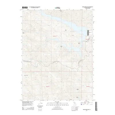
2015 Map of Warm Springs Dam
USGS Topo · Published 2015About this map
Lake Sonoma dominates this portion of Sonoma County, its intricate shoreline formed by the flooding of deep valleys behind the Warm Springs Dam. The hydrology of the region is defined by a dense network of drainages including Warm Springs Cr, Rancheria Cr, and the appropriately named Little Warm Springs Cr. The surrounding terrain rises sharply to prominent landmarks such as Pritchett Peaks and Bummer Peak, while the southern reaches of the map transitions into the sheltered depths of Redwood Canyon and Wildcat Canyon.
Find a feature on this map
43 named features on this map. Tap any name to fly to it.
Don’t see what you’re looking for? This feature index may not catch every label — zoom into the map to look around manually.
Map Details
Editions of this 2015 Warm Springs Dam Map
This is the sole edition of this map. No revisions or reprints were ever made.
Other maps of this area

1920 · Healdsburg
USGS Topo · 1:62,500

1921 · Skaggs
USGS Topo · 1:62,500

1921 · Kelseyville
USGS Topo · 1:62,500

1933 · Healdsburg
USGS Topo · 1:48,000

1938 · Hopland
USGS Topo · 1:62,500

1940 · Healdsburg
USGS Topo · 1:62,500

1943 · Tombs Creek
USGS Topo · 1:24,000

1943 · Cazadero
USGS Topo · 1:24,000

1943 · Skaggs Springs
USGS Topo · 1:24,000

1943 · Fort Ross
USGS Topo · 1:24,000